|
Historical Railway Photograph Gallery 2501-2550 |
|||||||||
|
Photos 2501-2550 |
|||||||||
| Photo | ELR | Branch | Subject | Location | M | C | Elev'n | Date | Time |
 bpm02501.jpg |
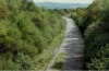
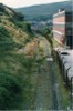
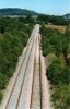
WVL | Park jct & Aberbeeg | Llanilleth | South | |||||
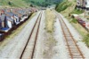
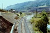
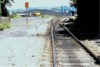
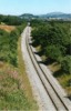
 bpm02502.jpg |
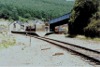
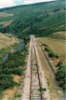
WVL | Park jct & Aberbeeg | Aberbeeg yard, signal box, junction & station | 14 | 19 | SE | |||
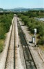
 bpm02503.jpg |
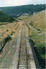
WVL | Park jct & Aberbeeg | Aberbeeg yard | 14 | 19 | North | |||
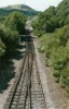
 bpm02504.jpg |
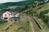
WVL | Park jct & Aberbeeg | Aberbeeg yard, jct & station | 14 | 19 | South | |||
 bpm02505.jpg |
WVL | Park jct & Aberbeeg | Aberbeeg jct & station | 14 | 22 | SW | |||
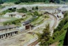
 bpm02506.jpg |
WVL | Park jct & Aberbeeg | Aberbeeg yard | 14 | 18 | Plan | |||
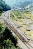
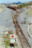
 bpm02507.jpg |
EBW | Aberbeeg jct & Ebbw Vale | North of Aberbeeg jct | 14 | 53.5 | SW | |||
 bpm02508.jpg |
EBW | Aberbeeg jct & Ebbw Vale | North of Aberbeeg jct | 14 | 53.5 | West | |||
 bpm02509.jpg |
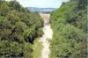
EBW | Aberbeeg jct & Ebbw Vale | Former Marine colliery, south of Cwm | North | |||||
 bpm02510.jpg |
EBW | Aberbeeg jct & Ebbw Vale | A4046 road overbridge , Cwm (Since taken out of use) | 16 | 31.5 | South | |||
 bpm02511.jpg |
EBW | Aberbeeg jct & Ebbw Vale | A4046 road overbridge , Cwm (Since replaced) | 16 | 72 | North | |||
 bpm02512.jpg |
EBW | Aberbeeg jct & Ebbw Vale | A4046 road overbridge , Cwm (Since replaced) | 16 | 72 | South | |||
 bpm02513.jpg |
EBW | Aberbeeg jct & Ebbw Vale | Footbridge north-west of Cwm | South | |||||
 bpm02514.jpg |
EBW | Aberbeeg jct & Ebbw Vale | Footbridge north-west of Cwm | North | |||||
 bpm02515.jpg |
EBW | Aberbeeg jct & Ebbw Vale | Victoria area south of Ebbw Vale | South | |||||
 bpm02516.jpg |
EBW | Aberbeeg jct & Ebbw Vale | Victoria area south of Ebbw Vale | North | |||||
 bpm02517.jpg |
EBW | Aberbeeg jct & Ebbw Vale | Ebbw Vale South Yard & groundframe NR/Corus boundary | 18 | 56 | South | |||
 bpm02518.jpg |
EBW | Aberbeeg jct & Ebbw Vale | Ebbw Vale SouthYard & groundframe NR/Corus boundary | 18 | 56 | South | |||
 bpm02519.jpg |
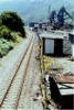
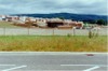
EBW | Aberbeeg jct & Ebbw Vale | Corus, Ebbw Vale steelworks complex | ~19 | 40 | East | |||
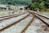
 bpm02520.jpg |
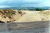
PEN | Penar jct & Oakdale colliery | Rhiw-sir-Dafydd level crossing , Oakdale | 7 | 03 | South | |||
 bpm02521.jpg |
PEN | Penar jct & Oakdale colliery | Rhiw-sir-Dafydd level crossing , Oakdale | 7 | 03 | North | |||
 bpm02522.jpg |
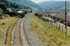
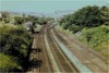
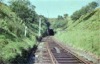
VON | Neath (General) & Pontypool Rd | Maesycwmmer junction looking west from A472 road overbridge, Maesycwmmer. The staggered junction (nearest aligned with the signal box at 10M-10C) led to Maesycwmmer junction on the Bassaleg & Rhymney branch at Fleur-de-Lis. The area immediately in front of the camera point is now partly backfilled, the only remaining part of the bridge being the east roadside wall. The zed-bend in the road over the bridge, has been straightened. The Hengoed viaduct lies beyond the junction | A472 road overbridge, Maesycwmmer | 10 | 7.5 | East | 28-Jul-63 | |
 bpm02523.jpg |
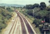
VON | Neath (General) & Pontypool Rd | Maesycwmmer junction looking west from A472 road overbridge, Maesycwmmer. The staggered junction and the signal box at 10M-10C have been removed and the Vale of Neath lines over Hengoed viaduct, lifted. Since the Bassaleg & Rhymney line south of Fleur-de-Lis had also been taken out of use, the connection to that line was maintained for coal traffic from Brittania colliery, Bargoed, until its final closure. Note the comparatively new telegraph rig on the left and the abandoned economy concrete sleepers on the lifted sidings on the right | A472 road overbridge, Maesycwmmer | 10 | 7.5 | East | ||
| bpm02524.jpg | SPARE | ||||||||
| bpm02525.jpg | SPARE | ||||||||
| bpm02526.jpg | SPARE | ||||||||
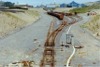
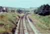
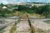
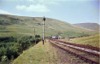 bpm02527.jpg |
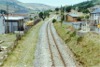
BND | Brecon & Dowlais | View of southern approach to former Torpantau station in the Brecon Beacons. The signal box, single to double line junction and a short spur are also to be seen although the 'box had been closed and the signal arms removed as the line was only open as a freight link to Brecon at the time | Single to double line junction to Torpantau station loop, NE end | 14 | 24.5 | South | 27-Jul-63 | |
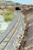
 bpm02528.jpg |
BND | Brecon & Dowlais | South-western approach to Torpantau tunnel after closure to passenger services and clipping & padlocking of points to station loop. (The red padlock is just visible) | Single to double line junction to Torpantau station loop, NE end | 14 | 07 | SW | 27-Jul-63 | |
 bpm02529.jpg |
WNT CAP PRS |
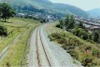
Walnut Tree jct & Penrhos jct (Walnut Tree)/Cardiff & Pontypridd/Penrhos | Penrhos North junction when all lines were in use. The single line on the left comes in from Pontypridd. It had been singled prior to 1959. The Penrhos-Aber double track diverges to the left and that to Caerphilly & Newport, to the right. | 3-arched unclasssified road overbridge immediately to the north of Penrhos signal box | 9 | 43 | South | ||
 bpm02530.jpg |
WNT CAP PRS |
Walnut Tree jct & Penrhos jct (Walnut Tree)/Cardiff & Pontypridd/Penrhos | Penrhos north junction after closure and lifting of the 'from Pontypridd' single line and the double line from the junction to Caerphilly. The remaining lines ran to Aber junction and the Rhymney valley and behind the camera point, from Walnut tree junction via the "big hill". Traffic was in decline by this time and after cessation of all coal traffic via this route, the only remaining route to the Rhymney valley was (and is) via Caerphilly tunnel | 3-arched unclasssified road overbridge immediately to the north of Penrhos signal box | 9 | 43 | South | ||
 bpm02531.jpg |
WNT CAP PRS |
Walnut Tree jct & Penrhos jct (Walnut Tree)/Cardiff & Pontypridd/Penrhos | Trackbed after closure and lifting. The branch to Caerphilly and Newport veered to the right at a point roughly opposite the electricity pole seen. The entire area is backfilled to a level above that of the camera and a housing estate now stands here (To within 200 feet of camera point). | 3-arched unclasssified road overbridge immediately to the north of Penrhos signal box | 9 | 43 | SW | 08-Apr-89 | 14.48 |
 bpm02532.jpg |
WNT CAP PRS |
Walnut Tree jct & Penrhos jct (Walnut Tree)/Cardiff & Pontypridd/Penrhos | A slightly later view of Penrhos north junction site after all lines had been lifted | 3-arched unclasssified road overbridge immediately to the north of Penrhos signal box | 9 | 43 | South | 13-May-89 | 11.12 |
 bpm02533.jpg |
WNT CAP PRS |
Walnut Tree jct & Penrhos jct (Walnut Tree)/Cardiff & Pontypridd/Penrhos | Partial backfilling in progress from the Caerphilly end towards Penrhos North junction at which point the backfill has reached | 3-arched unclasssified road overbridge immediately to the north of Penrhos signal box | 9 | 43 | South | ||
 bpm02534.jpg |
WNT CAP PRS |
Walnut Tree jct & Penrhos jct (Walnut Tree)/Cardiff & Pontypridd/Penrhos | The almost completed backfilling of the cuttings south and north of the former Penrhos North junction. Preparations for land drainage for the new housing estate are underway as evident by the mechanical equipment in the distance | 3-arched unclasssified road overbridge immediately to the north of Penrhos signal box | 9 | 43 | South | ||
 bpm02535.jpg |
WNT CAP PRS |
Walnut Tree jct & Penrhos jct (Walnut Tree)/Cardiff & Pontypridd/Penrhos | Construction of new housing estate on backfilled former lines to Aber Jct and Caerphilly West Jct. The road in the foreground is the new alignment immediately to the north of the 3-arched bridge near Penrhos signal box site | New unclassified road replacing old narrow road over 3-arched overbridge just north of Penrhos signal box site | 9 | 41.5 | South | ||
| bpm02536.jpg |
WNT CAP PRS |
Walnut Tree jct & Penrhos jct (Walnut Tree)/Cardiff & Pontypridd/Penrhos | Reserved for housing shot | 9 | 41.5 | South | |||
 bpm02537.jpg |
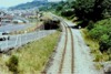
MDY | Maerdy | A foot-crossing south of Wattstown on the Maerdy branch. In January 2007 a new road had been laid on this formation. By May 2007, the road overbridge in the distance, had been removed | Foot crossing south of Wattstown | 17 | 50 | South | 02-Jul-89 | 09.50 |
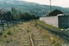 bpm02538.jpg |
MDY | Maerdy | View from a foot-crossing south of Wattstown on the Maerdy branch. By January 2007, a new trunk road had been laid on this formation | Foot crossing south of Wattstown | 17 | 50 | North | 02-Jul-89 | 09.50 |
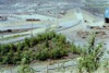
 bpm02539.jpg |
MDY | Maerdy | Looking north from a road overbridge at Pontygwaith after the track had been lifted. By January 2007, a new trunk road had been laid and opened on this alignment | Road overbridge at Pontygwaith | South | 02-Jul-89 | 10.08 | ||
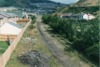
 bpm02540.jpg |
MDY | Maerdy | Looking north from a road overbridge at Stanleytown. By January 2007, a new trunk road and opened to a point just south of here | Road overbridge just north of former Tylorstown station | 18 | 60 | South | 02-Jul-89 | 10.13 |
 bpm02541.jpg |
MDY | Maerdy | Looking south from a road overbridge at Stanleytown. By May 2007, the entire scene here had been remodelled for road improvements | Road overbridge just north of former Tylorstown station | 18 | 58 | North | 02-Jul-89 | 10.30 |
 bpm02542.jpg |
MDY | Maerdy | Looking towards Ferndale from a footbridge across the valley east of Tylorstown | Footbridge crossing valley at Tylorstown | 19 | ? | South | 02-Jul-89 | 10.37 |
 bpm02543.jpg |
MDY | Maerdy | A view looking south towards Stanleytown and Pontygwaith from a footbridge east of Tylorstown | Footbridge crossing valley at Tylorstown | 19 | ? | North | 02-Jul-89 | 10.42 |
 bpm02544.jpg |
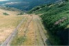
MDY | Maerdy | Looking north-west at the former Ferndale station site | Ferndale station site | 20 | 57.5 | SE | 02-Jul-89 | 11.29 |
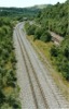
 bpm02545.jpg |
JER | Jersey Marine | The double line Jersey Marine branch looking towards Skewen from an overbridge south-east of Llandarcy | South-east of Llandarcy | South | 11-Jul-89 | 11.56 | ||
 bpm02546.jpg |
VON | Neath Riverside & Swansea Eastern Dep�t | Singled Vale of Neath line looking towards Skewen from an overbridge south-east of Llandarcy | South-east of Llandarcy | South | 11-Jul-89 | 11.56 | ||
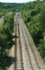
 bpm02547.jpg |
JER | Jersey Marine | Double line section of Rhondda & Swansea Bay lines south of Dynevor junction as seen from an overbridge just north of Jersey Marine Junction South | South-east of Llandarcy | South | 11-Jul-89 | 11.56� | ||
 bpm02548.jpg |
JER | Jersey Marine | Double to single line junction at south east end of Jersey Marine branch, as seen from an overbridge south-east of Llandarcy | South-east of Llandarcy | 20 | 06 | North | 11-Jul-89 | 11.57 |
 bpm02549.jpg |
VON | Neath Riverside & Swansea Eastern Dep�t | Single line Vale of Neath branch approaching Jersey Marine Junction south and as viewed from a road overbridge south-east of Llandarcy | South-east of Llandarcy | North | 11-Jul-89 | 11.58 | ||
 bpm02550.jpg |
JER | Jersey Marine | Double to single line junction at south east end of Jersey Marine branch, as seen from an overbridge south-east of Llandarcy | South-east of Llandarcy | North | 11-Jul-89 | 11.59 | ||
|
Photos 2501-2550 |
|||||||||
|
Date Last Revised:December 08, 2009 |
|||||||||